Caltech GPS Trip to Peru
One of the perks of being a graduate student at Catlech is the alumni wealth that is given to the Institute. For the Division of Geological and Planetary Sciences, one of the primary alumni benefactors are the Kliegel family. Many of our seminars are sponsored by this generous family. As well, the Kliegel family periodically funded educational and cultural trips for the undergraduate and graduate students. I was fortunate to go on one of these Kliegel-funded trips. We we went to Peru, where we learned about an ongoing Caltech geophysical campaign to observe slab subduction under Peru and about the Peruvian culture and history.
Day 3: A journey through the Sechura Desert
After a short visit to the Arequipa farmer’s market, where I discovered the amazing Granadilla fruits, we boarded our mini-buses and headed southwest on route 34/30 to the coastal town of Mollendo. Our goal was to visit a marine research institute on the coast, where we would wander through a marine museum filled with Victorian-era style exhibits, while traveling through the Sechura Desert, which is the northern portion of the Atacama Desert.
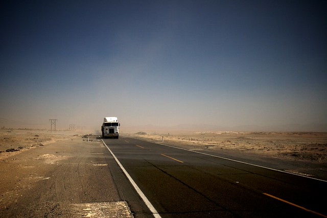
The Sechura Desert is a barren, dismal land filled with dust and dirt through which large trucks drive at high speeds transporting goods from the coastal port towns to Arequipa and beyond. The photograph below, taken during a stop in the middle of this desert, captures the bleakness of this extremely dry and rugged land. The Sechura, as part of the Atacama, is one of the driest places on Earth. Stepping out of the mini-bus onto the hard-packed rubble and dirt, breathing immediately became rougher as the dry, dust-filled air entering my mouth almost produced a gag reflex. As you can see in the photograph, everything has a grey-brown hue due to the dust floating and swirling about in the air. Though the desert seems to slowly oppress with its bleak landscape, the semi-trucks that barrel along the lone highway create an immediate sense of danger. The speeding trucks propelled more dust at us as we stood on the side of the road.
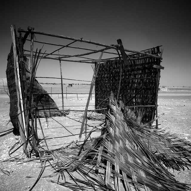
We stopped in this barren location in the middle of the Sechura in order to see the small field of dunes that swept across this region. But before we explored thos dunes, we encountered a field of small shacks on both sides of the highway. The shack in the photo below is typical of these structures that we found in the Sechura. With a basic frame made from thin logs, and walls and roofs made of woven reeds, these flimsy structures barely qualified as shacks. Most of the shacks had clearly been worn down by the wind and bleached by the sun. With no obvious source of water in one of the driest deserts on Earth, we were never sure why these shacks were built out there.
Interspersed between these ramshackle shacks as the reason for our stop: barchan dunes! Barchan dunes have a distinctive wing-shape, when seen from above, and are one of the types of dunes that we have observed on more than one planet. A satellite view of the Martian barchan dunes shows that these dunes form groups that stretch across large landscapes. The Earth barchan dunes also form as a field of dunes, sweeping across a desert landscape at a pretty fast pace. If you return to one of these fields a few years later you would find that the dunes you had previously seen had moved large distants and may even have merged or collided with other dunes. Since we were a caravan of geoscientists, we had to stop and scramble over these magnificent sand formations.
In the photograph below, Dr. Rob Clayton, Dr. Mark Simons, and Dr. Jean-Paul Ampuero debate barchan formation while right before them sand saltates off the edge of the dune. The three of them are standing on top of one of the large barchan dunes in that area. The dune reached up to almost ten meters in height and stretched tens of meters along the two primary branches of the dune.
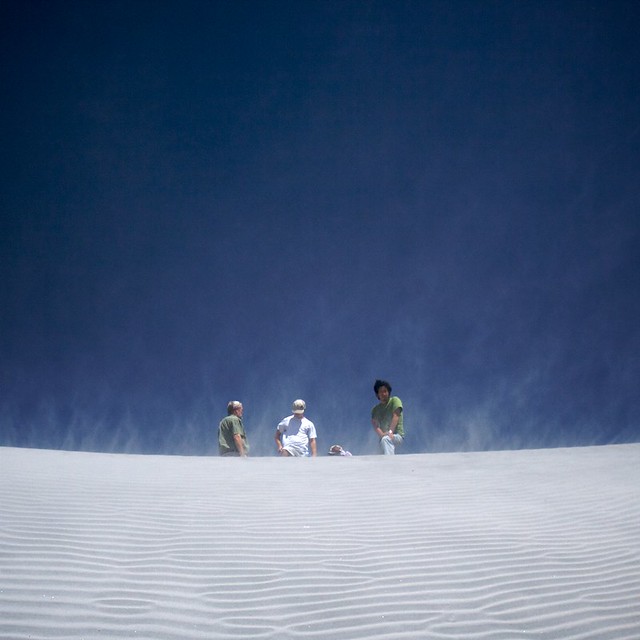
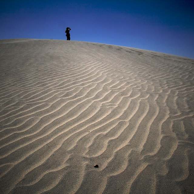
Dr. Michelle Selvans climbed up another tall dune and looked off into the distance while before the windward side of the dune (see photograph below). This windward slope was shallow and covered with aeolian ripples. Ripples like these have been seen on Mars.
#Day 4: The Drive to Colca Canyon
After a morning of wandering the streets of Arequipa and visiting a few churches, we hopped into our mini-buses and headed inland, towards Colca Canyon, a popular location for Andean condor watching. This was mostly a travel day, with plenty of amazing Andean vistas oustide our windows. Fortunately, we had the occasional stop along the way.
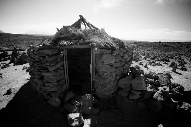
One of our stops was at the top of a high altitude pass where we found simple huts and rock formations near the road. The photograph below shows one of the stone huts that we found.